 Map title: “cities and villages (in Greece) destroyed during the 1940-45 war – 1st edition Athens 1945.”
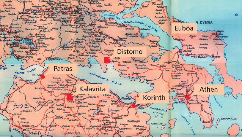
The map was produced by the Greek Ministry of Social Affairs in preparation for the inter-allied reparations conference in Paris at the turn of the year 1945/6. Today it is situated at the Greek parliamentary archive and was shown publicly again in the context of the newly flared up debate about crimes committed by SS and German Wehrmacht during the Nazi occupation.  The original map only shows those villages and cities destroyed partially or wholly by German troops during the occupation. It separates between 25%, 50%, 75% degrees of destruction and “totally destroyed” (See explanatory notes to the left below). In all of these cases many civilians also got killed by German occupying forces. FaktenCheck:Hellas marked a few of the most important cities with Latin letters (red dots). We also marked nine places were especially notorious massacres took place (red squares). Distomo (Böotia), Viannos and Anogia (both Crete), Kalavryta (Peleponnes), Kommeno, Moussiotitsa, Lyngiades (Epirus), Chortiatis (both Thessaloniki) and Doxato (near Drama). We finally mark Thessaloniki especially as the place where the Jewish population was interned and sent by rail to NS death camps (at least 46.000 people got killed this way). 99 places are today known as “places of the martyrs” or “cities of the martyrs”. These got almost completely destroyed with a large part of their population murdered.

